Just realised I have to upload to photobucket before I can post! Might take some time...
You don't have to go via photobucket. If you use "reply" (not quick reply) you will see below the text box the underlined "upload manager". When you click on this, and then on "browse" you can navigate to where your picture is on your hard drive. Select what you want and then "add file". The pic is then attached to your post. Make sure you don't exceed the size limits which are shown in upload manager.
That's interesting - I'd got that tramways postcard to somewhere between 1900 and 1920, so that bit about Warren Station puts it before 1915. I grew up on Broadway Avenue which, on this map, is still called Townfield Lane. Rolleston Drive hasn't been built to link Belvidere Road and Sea Road, either.
That's interesting - I'd got that tramways postcard to somewhere between 1900 and 1920, so that bit about Warren Station puts it before 1915. I grew up on Broadway Avenue which, on this map, is still called Townfield Lane. Rolleston Drive hasn't been built to link Belvidere Road and Sea Road, either.
I wouldn't be too sure about the date of the postcard. It must originally have been produced while the station was still there, but it could have been re-printed later from the original plate in order to save the cost of producing a new one.
Thanks, Zipper. I see that the picture was taken after the closure and demolition of the down platform. The up platform remained until after electrification in 1938.
From the picture Zip, I see Warren Station was immediately next to the bridge over Sea Road. Note the change from transverse sleepers to the longitudinal beams on the down line. These beams were usual when the rails were carried over a bridge.
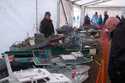
I was wondering if the picture was taken immediately prior to electricfication (1938). Note what looks like concrete cable troughing stacked on the platform ready for laying. Maybe for the 3rd rail cabling? I doubt if they would be for phone circuits, as at that time all phone and telegraph routes were open wire on poles, crossarms and insulators*.
Also note on the map Ginger Lane, on the old 1911 Godfrey map this is called Cinder Lane and it ran from Sherlock Lane to Oakdale Rd. Does anybody know if was ever called Ginger Lane or is it a typo form the map makers?