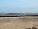
Any one who wants to see the remains of the platform at Limekiln lane/St pauls road. Get the train at Green lane station up to rock ferry station at Bedford road. sit on the left hand side of the carrige and keep looking out of the window and you will see the remains of the platform prior to reaching rock ferry station.
Ships that pass in the night, seldom seen and soon forgoten
Yes, St.Paul's Rd. was previously Lime Kiln Lane. Pitt St. was the next street South of St. Paul's Rd. See map from about 1912. It would have been roughly where Fairhaven Close is now. No pictures are known of the station, which pre-dated Rock Ferry station, but there seems to be some evidence of a possible station entrance in the Southern bridge abutment in the form of a patch of glazed white brick. By the time of this map, the station was long closed & the new one opened at Rock Ferry.
Very interested in this map as it shows where I used to live.
Thanks Chriskay. It's your 1912 map that Nienna is enquiring about. Mine are from the Cassini OS 'Past and Present Map - The Wirral' (1840, 1902, 1923 & modern) - very good but considers Wirral to be the council area (i.e. north Wirral) instead of the whole peninsula. Therefore 40% of proper Wirral missing.
Re. Rock Lane station; the Godfrey edition O.S. map of 1899 seems to show some remains of this station. There appear to be some buildings & a ramp down from the road (the line is in a cutting here).